Geography of Andalusia
 Sierra Nevada
The region is crisscrossed west to east by two mountain ranges; the low-lying Sierra Morena which forms its northern boundary with the Castilian meseta and the Bética ranges to the south, made up of a series of ranges including the Sierra Nevada home to the highest peaks in Iberia : Mulhacén (3478 m.) and Veleta (3392 m.). Between the Bética mountains and the Sierra Morena lies the Guadalquivir Valley, the flattest expanse in Spain ( Seville, for instance, is just 9m above sea level yet is 100km from the coast ). Running in parallel from north to south, t hese three elements: the Sierra Morena, the Guadalquivir Depression and the Betica mountains basically define Andalusia . Most of Andalusia can be considered as mountainous with some 50% lying above 600m.
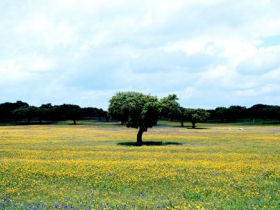
 Image: CMA de la Junta de Andalucía
Provinces and surface area of Andalusia in km2
| Andalucía |
87597 |
| Almería |
8775 |
| Cádiz |
7436 |
| Córdoba |
13771 |
| Granada |
12647 |
| Huelva |
10128 |
| Jaén |
13496 |
| Málaga |
7308 |
| Sevilla |
14036 |
Highest moutains in Andalusia / Highest moutains in Andalucia
| Province | Name | Range | Height in metres |
| Huelva | Cerro Bonales | Sierra de Bonales | 1055 |
| Cádiz | Torreón del Pinar | Sierra de Grazalema | 1654 |
| Sevilla | Terril | Sierra del Tablón | 1129 |
| Córdoba | Tiñosa | Sierra de Horconera | 1570 |
| Málaga | Maroma | Sierra de Tejeda | 2066 |
| Jaén | Mágina | Sierra Mágina | 2167 |
| Granada | Mulhacén
Veleta Alcazaba |
Sierra de Cazorla | 3482
3392 3366 |
| Almería | Chullo | Sierra de Cazorla | 2609 |
- Albufera de Adra
- Bahia de Cadiz
- Cabo de Gata-Nijar
- Climate of Andalusia
- Doñana
- Flora and wildlife of Andalusia
- Geography of Andalusia
- Grazalema
- History of Andalucia
- Laguna de Fuente de Piedra
- Las Dehesas de Sierra Morena
- Las Sierras de Cazorla y Segura
- Los Alcornocales
- Nature reserves in Andalusia
- Ordiel Marshes
- Sierra Nevada
- Aiguamolls de l’Empordà Natural Park
- Aigüestortes i Estany de Sant Maurici
- Birding sites in Catalonia
- Cap de Creus
- Catalonia earthquake of 1428
- Congost de Mont-rebei / Mont-rebei gorge
- Delta del Ebro
- Els Ports
- Garraf
- Lake Banyoles
- Lerida Steppes
- Montseny
- Pica d’Estats
- Sant Llorenç del Munt
- Serra de Montsec
- Sierra de Cadi
The Iberianature guide to Spain


 Andalusia with its rugged mountains and stunning scenery offers some of the best hiking in Europe.