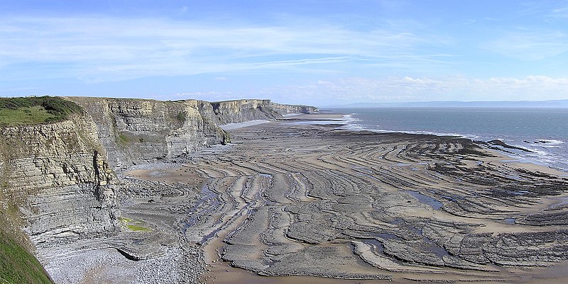
Superb example of a wave-cut platform at Southerndown, South Wales.
Photo by Yummifruitbat on Wikipedia.
Superb example of a wave-cut platform at Southerndown, South Wales.
Photo by Yummifruitbat on Wikipedia.

When asked what he thought about The Giant’s Causeway Dr Samuel Johnson proclaimed “Worth seeing, yes; but not worth going to see”. We may very well disagree with his cynicism but this is surely one of the most insightful comments on the activity of tourism.

This week’s In Our Time, the ever erudite BBC Radio 4 series chaired by Melvyn Bragg, looks at the geological formation of Britain. The panel of experts discuss how Britain came to be where it is now, charting its separation of North America and Europe to the carving out of the English Channel, and also what is still not understand about the rocks beneath us. Available on demand hopefully forever here.
Around six hundred million years ago, the island that we now call Britain was in two parts, far to the south of the Equator. Scotland – and north-western Ireland – were part of a continent (Laurentia) that also included what is now North America. To the south-east, near the Antarctic Circle, meanwhile, you would have found Southern Ireland, England and Wales. They formed a mini-continent (Avalonia) with what is now Newfoundland. Over the course of hundreds of millions of years, as they inched their way north, the two parts came together, first as part of a vast unitary continent (Pangaea), later as a promontory on the edge of Europe, and eventually, as sea levels rose, as an island.
In the photo the so-called Jurassic Coast along the coast of southern England from Wikipedia by Jim Chapmion.